Evaluating the Geotechnical and Geophysical Characteristics of Expanding Districts in Tehran Using Field Experiments
Downloads
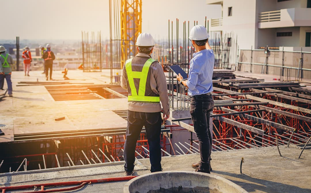
Considering the increasing population growth and the rapid growth of urbanization and pollution in the environment, providing zoning maps and urban engineering geology seem to be important. The rapid construction growth of cities, as well as the confrontation with events such as earthquakes and failure to observe the geological and geotechnical issues, has caused many engineering problems. The use of geophysical methods not only cannot lonely provide us a complete and comprehensive information on the geotechnical conditions of the earth but also has many disturbances in urban areas, and its use in urban centers is almost impractical. Therefore, it seems that the best way of examining and interpreting the geotechnical characteristics of a site, especially in urban areas, is the use of suspicious data. Therefore, performing geotechnical studies and geotechnical zoning can be useful for retrofitting buildings and engineering structures and reducing their risks. Hence, zoning studies are conducted in this research in order to better recognize the technical soil status for safe construction due to rising the population of Tehran in recent decades and the concentration of population in certain areas of Tehran, especially in the eastern and western regions (districts 4 and 22). In this study, different geotechnical field tests such as standard penetration test (SPT), cone penetration test (CPT) were used to estimate parameters such as adhesion coefficient (C), internal friction angle ( ), Young modulus (E). Other common experiments with conventional geophysical experiments, such as in good experiments, refractive and CSSW were applied to estimate geophysical parameters of bedrock depth and shear wave velocity for zoning these areas.
Downloads
[2] Ejelooeian, Rasool, Farashi, Sara. "Geotechnical zoning of Isfahan city using GIS”. 4th international conference on geotechnics and soil mechanics, Tehran, Iran. (2010).
[3] Labib, Mary, and Amani Nashed. "GIS and geotechnical mapping of expansive soil in Toshka region." Ain Shams Engineering Journal 4.3 (2013): 423-433. Doi: 10.1016/j.asej.2012.11.005.
[4] Sharma, Binu, and Shaffi Kamal Rahman. "Use of GIS Based Maps for Preliminary Assessment of Subsoil of Guwahati City." Journal of Geoscience and Environment Protection 4.05 (2016): 106. Doi: 10.4236/gep.2016.45011.
[5] Wan-Mohamad, W. N. S., and A. N. Abdul-Ghani. "The use of geographic information system (GIS) for geotechnical data processing and presentation." Procedia Engineering 20 (2011): 397-406. Doi: 10.1016/j.proeng.2011.11.182.
[6] Juárez, Moisés, Auvinet, Gabriel, Méndez, Edgar. "Advances in the geotechnical characterization of Mexico City basin subsoil”, Pan-Am CGS Geotechnical Confrence, (2011). Doi: 10.1016/j.riit.2016.07.001.
[7] Baghban Golpasand, Mohammad Reza, Mohammad Reza Nikudel, and Ali Uromeihy. "Effect of engineering geological characteristics of Tehran's recent alluvia on ground settlement due to tunneling." Geopersia 4.2 (2014): 185-199. Doi: 0.1007/s10064-015-0788-8.
[8] Epada, Pouyon Dieudonné, Ganno Sylvestre, and Tabod Charles Tabod. "Geophysical and geotechnical investigations of a landslide in Kekem area, western Cameroon." International Journal of Geosciences 3.04 (2012): 780. Doi: 10.4236/ijg.2012.34079.
[9] Adewoyin, Olusegun O., Emmanuel O. Joshua, and Marvel L. Akinyemi. "Application of Geophysical and Geotechnical Methods to Determine the Geotechnical Characteristics of a Reclaimed Land." International Conference and Exhibition, Barcelona, Spain, 3-6 April 2016. Society of Exploration Geophysicists and American Association of Petroleum Geologists, 2016. Doi: 10.1190/ice2016-6461214.1.
[10] Shan, Chunling, et al. "Integrated 2D modeling and interpretation of geophysical and geotechnical data to delineate quick clays at a landslide site in southwest Sweden." Geophysics (2014). Doi: 10.1190/geo2013-0201.1.
[11] Oyedele, K. F., S. Oladele, and O. Adedoyin. "Application of geophysical and geotechnical methods to site characterization for construction purposes at Ikoyi, Lagos, Nigeria." Journal of Earth Sciences and Geotechnical Engineering 1.1 (2011): 87-100. Doi: 10.12983/ijsrk-2014-p0083-0091.
[12] Titi Dej, Omid. "ArcGIS Tutorial and GIS Concepts”, Second Edition. Publication of shomalpaydar Cultural and Artistic Institute, Shomal University, 600 pages. (2005).
[13] Japan International Cooperation Agency (JICA), Seismic micro zoning report of Grand Tehran. (2001). Doi: 10.18178/ijesd.2017.8.10.1051.
10.18178/ijesd.2017.8.10.1051.
[14] Gamil, Yaser, and Ismail Abdul Rahman. "Identification of Causes and Effects of Poor Communication in Construction Industry: A Theoretical Review.” Emerging Science Journal 1, no. 4 (January 10, 2018). doi:10.28991/ijse-01121.
- Authors retain all copyrights. It is noticeable that authors will not be forced to sign any copyright transfer agreements.
- This work (including HTML and PDF Files) is licensed under a Creative Commons Attribution 4.0 International License.![]()


