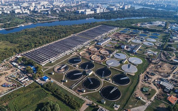
Estimation of the Physical Progress of Work Using UAV and BIM in Construction Projects
Downloads
Doi:10.28991/CEJ-2024-010-02-02
Full Text:PDF
Downloads
[2] Awed, A. M., Maher, A., Abozied, M. A. H., & Elhalwagy, Y. Z. (2023). Towards realizing a visual UAV flying environment: A novel approach based aerial imagery to construct a dataset for visual servoing. Engineering Applications of Artificial Intelligence, 122, 106098. doi:10.1016/j.engappai.2023.106098.
[3] Jiang, W., Zhou, Y., Ding, L., Zhou, C., & Ning, X. (2020). UAV-based 3D reconstruction for hoist site mapping and layout planning in petrochemical construction. Automation in Construction, 113, 103137. doi:10.1016/j.autcon.2020.103137.
[4] Li, F., Laili, Y., Chen, X., Lou, Y., Wang, C., Yang, H., Gao, X., & Han, H. (2023). Towards big data driven construction industry. Journal of Industrial Information Integration, 35, 100483. doi:10.1016/j.jii.2023.100483.
[5] Elkhapery, B., PÄ›niÄka, R., NÄ›mec, M., & Siddiqui, M. (2023). Metaheuristic planner for cooperative multi-agent wall construction with UAVs. Automation in Construction, 152, 104908. doi:10.1016/j.autcon.2023.104908.
[6] Pan, Y., & Zhang, L. (2021). Automated process discovery from event logs in BIM construction projects. Automation in Construction, 127, 103713. doi:10.1016/j.autcon.2021.103713.
[7] Alizadehsalehi, S., & Yitmen, I. (2016). The Impact of Field Data Capturing Technologies on Automated Construction Project Progress Monitoring. Procedia Engineering, 161, 97–103. doi:10.1016/j.proeng.2016.08.504.
[8] Song, C., Chen, Z., Wang, K., Luo, H., & Cheng, J. C. P. (2022). BIM-supported scan and flight planning for fully autonomous LiDAR-carrying UAVs. Automation in Construction, 142, 104533. doi:10.1016/j.autcon.2022.104533.
[9] Siebert, S., & Teizer, J. (2014). Mobile 3D mapping for surveying earthwork projects using an Unmanned Aerial Vehicle (UAV) system. Automation in Construction, 41, 1–14. doi:10.1016/j.autcon.2014.01.004.
[10] Mourtzis, D., Angelopoulos, J., & Panopoulos, N. (2022). Unmanned Aerial Vehicle (UAV) manipulation assisted by Augmented Reality (AR): The case of a drone. IFAC-PapersOnLine, 55(10), 983–988. doi:10.1016/j.ifacol.2022.09.483.
[11] Matlekovic, L., Juric, F., & Schneider-Kamp, P. (2022). Microservices for autonomous UAV inspection with UAV simulation as a service. Simulation Modelling Practice and Theory, 119, 102548. doi:10.1016/j.simpat.2022.102548.
[12] Alam, M. M., & Moh, S. (2022). Joint topology control and routing in a UAV swarm for crowd surveillance. Journal of Network and Computer Applications, 204, 103427. doi:10.1016/j.jnca.2022.103427.
[13] Nwaogu, J. M., Yang, Y., Chan, A. P. C., & Chi, H. (2023). Application of drones in the architecture, engineering, and construction (AEC) industry. Automation in Construction, 150, 104827. doi:10.1016/j.autcon.2023.104827.
[14] Zhang, J., Xu, S., Zhao, Y., Sun, J., Xu, S., & Zhang, X. (2023). Aerial orthoimage generation for UAV remote sensing: Review. Information Fusion, 89, 91–120. doi:10.1016/j.inffus.2022.08.007.
[15] Chen, Q., Chen, J., & Huang, W. (2022). Pathfinding method for an indoor drone based on a BIM-semantic model. Advanced Engineering Informatics, 53, 101686. doi:10.1016/j.aei.2022.101686.
[16] Meyer, T., Brunn, A., & Stilla, U. (2023). Geometric BIM verification of indoor construction sites by photogrammetric point clouds and evidence theory. ISPRS Journal of Photogrammetry and Remote Sensing, 195, 432–445. doi:10.1016/j.isprsjprs.2022.12.014.
[17] Meyer, T., Brunn, A., & Stilla, U. (2022). Change detection for indoor construction progress monitoring based on BIM, point clouds and uncertainties. Automation in Construction, 141, 104442. doi:10.1016/j.autcon.2022.104442.
[18] Reja, V. K., Varghese, K., & Ha, Q. P. (2022). Computer vision-based construction progress monitoring. Automation in Construction, 138, 104245. doi:10.1016/j.autcon.2022.104245.
[19] Sheikhkhoshkar, M., Pour Rahimian, F., Kaveh, M. H., Hosseini, M. R., & Edwards, D. J. (2019). Automated planning of concrete joint layouts with 4D-BIM. Automation in Construction, 107, 102943. doi:10.1016/j.autcon.2019.102943.
[20] Abuaddous, M., Al-Btoosh, J. A. A., Al-Btoush, M. A. K. A., & Alkherret, A. J. (2020). Building Information Modeling Strategy in Mitigating Variation Orders in Roads Projects. Civil Engineering Journal, 6(10), 1974–1982. doi:10.28991/cej-2020-03091596.
[21] Kiriiak, N. (2021). Development and implementation of technical decision for digital support of construction using photogrammetry methods. Nuclear Engineering and Design, 381, 111366. doi:10.1016/j.nucengdes.2021.111366.
[22] Melo, R. R. S. de, Costa, D. B., ílvares, J. S., & Irizarry, J. (2017). Applicability of unmanned aerial system (UAS) for safety inspection on construction sites. Safety Science, 98, 174–185. doi:10.1016/j.ssci.2017.06.008.
[23] Ellenberg, A., Kontsos, A., Moon, F., & Bartoli, I. (2016). Bridge related damage quantification using unmanned aerial vehicle imagery. Structural Control and Health Monitoring, 23(9), 1168–1179. Portico. https://doi.org/10.1002/stc.1831.
[24] Huang, H., Long, J., Lin, H., Zhang, L., Yi, W., & Lei, B. (2017). Unmanned aerial vehicle based remote sensing method for monitoring a steep mountainous slope in the Three Gorges Reservoir, China. Earth Science Informatics, 10(3), 287–301. doi:10.1007/s12145-017-0291-9.
[25] Rengaraju, P., Pandian, S. R., & Lung, C.-H. (2014). Communication networks and non-technical energy loss control system for smart grid networks. 2014 IEEE Innovative Smart Grid Technologies - Asia (ISGT ASIA), Kuala Lumpur, Malaysia. doi:10.1109/isgt-asia.2014.6873828.
[26] Jones, D. I. (2007, June). An experimental power pick-up mechanism for an electrically driven UAV. 2007 IEEE International Symposium on Industrial Electronics, Vigo, Spain. doi:10.1109/isie.2007.4374920.
[27] Wei, W., Lu, Y., Lin, Y., Bai, R., Zhang, Y., Wang, H., & Li, P. (2023). Augmenting progress monitoring in soil-foundation construction utilizing SOLOv2-based instance segmentation and visual BIM representation. Automation in Construction, 155, 105048. doi:10.1016/j.autcon.2023.105048.
[28] Kamari, M., & Ham, Y. (2022). AI-based risk assessment for construction site disaster preparedness through deep learning-based digital twinning. Automation in Construction, 134, 104091. doi:10.1016/j.autcon.2021.104091.
[29] Zhang, C., Wang, F., Zou, Y., Dimyadi, J., Guo, B. H. W., & Hou, L. (2023). Automated UAV image-to-BIM registration for building façade inspection using improved generalised Hough transform. Automation in Construction, 153, 104957. doi:10.1016/j.autcon.2023.104957.
[30] Jia, S., Liu, C., Guan, X., Wu, H., Zeng, D., & Guo, J. (2022). Bidirectional interaction between BIM and construction processes using a multisource geospatial data enabled point cloud model. Automation in Construction, 134, 104096. doi:10.1016/j.autcon.2021.104096.
[31] Han, K. K., Cline, D., & Golparvar-Fard, M. (2015). Formalized knowledge of construction sequencing for visual monitoring of work-in-progress via incomplete point clouds and low-LoD 4D BIMs. Advanced Engineering Informatics, 29(4), 889–901. doi:10.1016/j.aei.2015.10.006.
[32] Dupont, Q. F. M., Chua, D. K. H., Tashrif, A., & Abbott, E. L. S. (2017). Potential Applications of UAV along the Construction's Value Chain. Procedia Engineering, 182, 165–173. doi:10.1016/j.proeng.2017.03.155.
[33] Sampaio, A. Z. (2023). BIM training course improving skills of Construction industry professionals. Procedia Computer Science, 219, 2035–2042. doi:10.1016/j.procs.2023.01.505.
[34] Mohammad El-Basioni, B. M., & Abd El-Kader, S. M. (2023). Mission-based PTR triangle for multi-UAV systems flight planning. Ad Hoc Networks, 142, 103115. doi:10.1016/j.adhoc.2023.103115.
[35] Jain, G., Yadav, G., Prakash, D., Shukla, A., & Tiwari, R. (2019). MVO-based path planning scheme with coordination of UAVs in 3-D environment. Journal of Computational Science, 37, 101016. doi:10.1016/j.jocs.2019.07.003.
[36] Bori, M. M., & Hussein, Z. E. (2020). Integration the Low Cost Camera Images with the Google Earth Dataset to Create a 3D Model. Civil Engineering Journal, 6(3), 446–458. doi:10.28991/cej-2020-03091482.
[37] Ham, Y., Han, K. K., Lin, J. J., & Golparvar-Fard, M. (2016). Visual monitoring of civil infrastructure systems via camera-equipped Unmanned Aerial Vehicles (UAVs): a review of related works. Visualization in Engineering, 4(1), 1-8. doi:10.1186/s40327-015-0029-z.
[38] Han, Y., Feng, D., Wu, W., Yu, X., Wu, G., & Liu, J. (2023). Geometric shape measurement and its application in bridge construction based on UAV and terrestrial laser scanner. Automation in Construction, 151, 104880. doi:10.1016/j.autcon.2023.104880.
[39] Tan, Y., Li, G., Cai, R., Ma, J., & Wang, M. (2022). Mapping and modelling defect data from UAV captured images to BIM for building external wall inspection. Automation in Construction, 139, 104284. doi:10.1016/j.autcon.2022.104284.
[40] Jeelani, I., & Gheisari, M. (2021). Safety challenges of UAV integration in construction: Conceptual analysis and future research roadmap. Safety Science, 144, 105473. doi:10.1016/j.ssci.2021.105473.
[41] Pour Rahimian, F., Seyedzadeh, S., Oliver, S., Rodriguez, S., & Dawood, N. (2020). On-demand monitoring of construction projects through a game-like hybrid application of BIM and machine learning. Automation in Construction, 110, 103012. doi:10.1016/j.autcon.2019.103012.
[42] Freimuth, H., & König, M. (2018). Planning and executing construction inspections with unmanned aerial vehicles. Automation in Construction, 96, 540–553. doi:10.1016/j.autcon.2018.10.016.
- Authors retain all copyrights. It is noticeable that authors will not be forced to sign any copyright transfer agreements.
- This work (including HTML and PDF Files) is licensed under a Creative Commons Attribution 4.0 International License.![]()


